


Cleveland Voting District, Fulton County, Arkansas
About
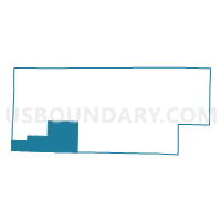
Outline

Summary
| Unique Area Identifier | 526505 |
| Name | Cleveland Voting District |
| County | Fulton County |
| State | Arkansas |
| Area (square miles) | 54.67 |
| Land Area (square miles) | 54.44 |
| Water Area (square miles) | 0.23 |
| % of Land Area | 99.58 |
| % of Water Area | 0.42 |
| Latitude of the Internal Point | 36.30133450 |
| Longtitude of the Internal Point | -92.01461780 |
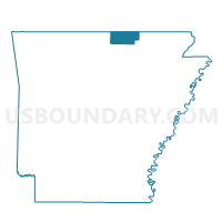
Maps

Graphs
Select a template below for downloading or customizing gragh for Cleveland Voting District, Fulton County, Arkansas


Neighbors
Neighoring Voting District (by Name) Neighboring Voting District on the Map
- Voting District 11-9, Baxter County, AR
- Voting District 3-4, Baxter County, AR
- Benton Voting District, Fulton County, AR
- Big Creek Voting District, Fulton County, AR
- DOLPH Voting District, Izard County, AR
- Fulton Voting District, Fulton County, AR
- OXFORD RURAL Voting District, Izard County, AR
- OXFORD WARD 1, Izard County, AR
- OXFORD WARD 2, Izard County, AR
- Union Voting District, Fulton County, AR
- WIDEMAN Voting District, Izard County, AR
Top 10 Neighboring County Subdivision (by Population) Neighboring County Subdivision on the Map
- Benton township, Fulton County, AR (2,564)
- Union township, Baxter County, AR (1,856)
- North Fork township, Baxter County, AR (1,574)
- Fulton township, Fulton County, AR (1,049)
- New Hope township, Izard County, AR (956)
- Cleveland township, Fulton County, AR (514)
- Bryan township, Izard County, AR (436)
- Big Creek township, Fulton County, AR (428)
- Union township, Fulton County, AR (303)
- Guthrie township, Izard County, AR (109)
Top 10 Neighboring Place (by Population) Neighboring Place on the Map
Top 10 Neighboring Unified School District (by Population) Neighboring Unified School District on the Map
- Izard Cty Consolidated Schools, AR (4,831)
- Salem School District, AR (4,684)
- Norfork Schools, AR (3,800)
- Calico Rock School District, AR (3,587)
- Viola School District, AR (3,223)
Top 10 Neighboring State Legislative District Lower Chamber (by Population) Neighboring State Legislative District Lower Chamber on the Map
Top 10 Neighboring State Legislative District Upper Chamber (by Population) Neighboring State Legislative District Upper Chamber on the Map
Top 10 Neighboring 111th Congressional District (by Population) Neighboring 111th Congressional District on the Map
Top 10 Neighboring Census Tract (by Population) Neighboring Census Tract on the Map
- Census Tract 5502, Fulton County, AR (6,287)
- Census Tract 9602, Izard County, AR (5,062)
- Census Tract 9505, Baxter County, AR (4,962)
- Census Tract 9506, Baxter County, AR (3,816)
- Census Tract 9603, Izard County, AR (2,958)
Top 10 Neighboring 5-Digit ZIP Code Tabulation Area (by Population) Neighboring 5-Digit ZIP Code Tabulation Area on the Map
- 72576, AR (3,868)
- 72519, AR (3,150)
- 72583, AR (1,679)
- 72565, AR (999)
- 72531, AR (800)
- 72566, AR (624)
- 72515, AR (63)